Splitting the Colorado River’s Flow | Volume I, Issue 3 of Water Time Reflections
How Did Compact Negotiators Split the Colorado River’s Flow in 1922?
Volume 1, Issue 3 of Water Time Reflections
Author: Steve Harris, Water Engineer, Certified Water Buffalo, and Southwest Coloradoan
For my third installment in our discussion of the 100-year anniversary of the Colorado River Compact in 1922, I’ll describe how the states negotiated their respective share of the annual flow of the Colorado River. Though I was not in attendance in 1922, the minutes of the negotiations are very thorough.
A few definitions before we start:
- “WY” is short for the federal water year from October 1st to September 30th. Colorado water years are November to October.
- AF is acre-feet or 325,851 gallons or 43,560 cubic feet.
- MAF is million acre-feet.
Actual Colorado River flows in 1922: At the first Colorado River Compact Commission (CRCC) meeting on January 30, 1922, data on the flow of the Colorado River at various locations was provided by the US Geological Survey Director. Below are highlights of the flow data that was available (page 104 of those minutes):
- Green River at Green River WY 1894 -1919 with 5,690,000 AF average
- San Juan River near Bluff WY 1914-1917 with 3,090,000 AF average
- Colorado River near Fruita WY 1908-1919 with 6,540,000 AF average
- Colorado River near Topock WY (next to the I-40 bridge across the Colorado River) 1917-1919 with 15,730,000 AF average
- Colorado River near Yuma WY 1902-1920 with 17,400,000 AF average
It should be noted that the period for most of these data was considered to be wetter than normal. By 1922, most of the major irrigation ditches in the Upper Basin had been constructed and were diverting during the periods the flow data above was collected. However, there were very few reservoirs constructed by 1922. Today, modelers try to estimate “natural” flows but the CRCC made no such attempt. Instead, the CRCC based the compact on the fact that the flow records included Upper Basin diversion, which is why they included the clause “Present perfected rights to the beneficial use of the waters of the Colorado River System are unimpaired by this compact.”
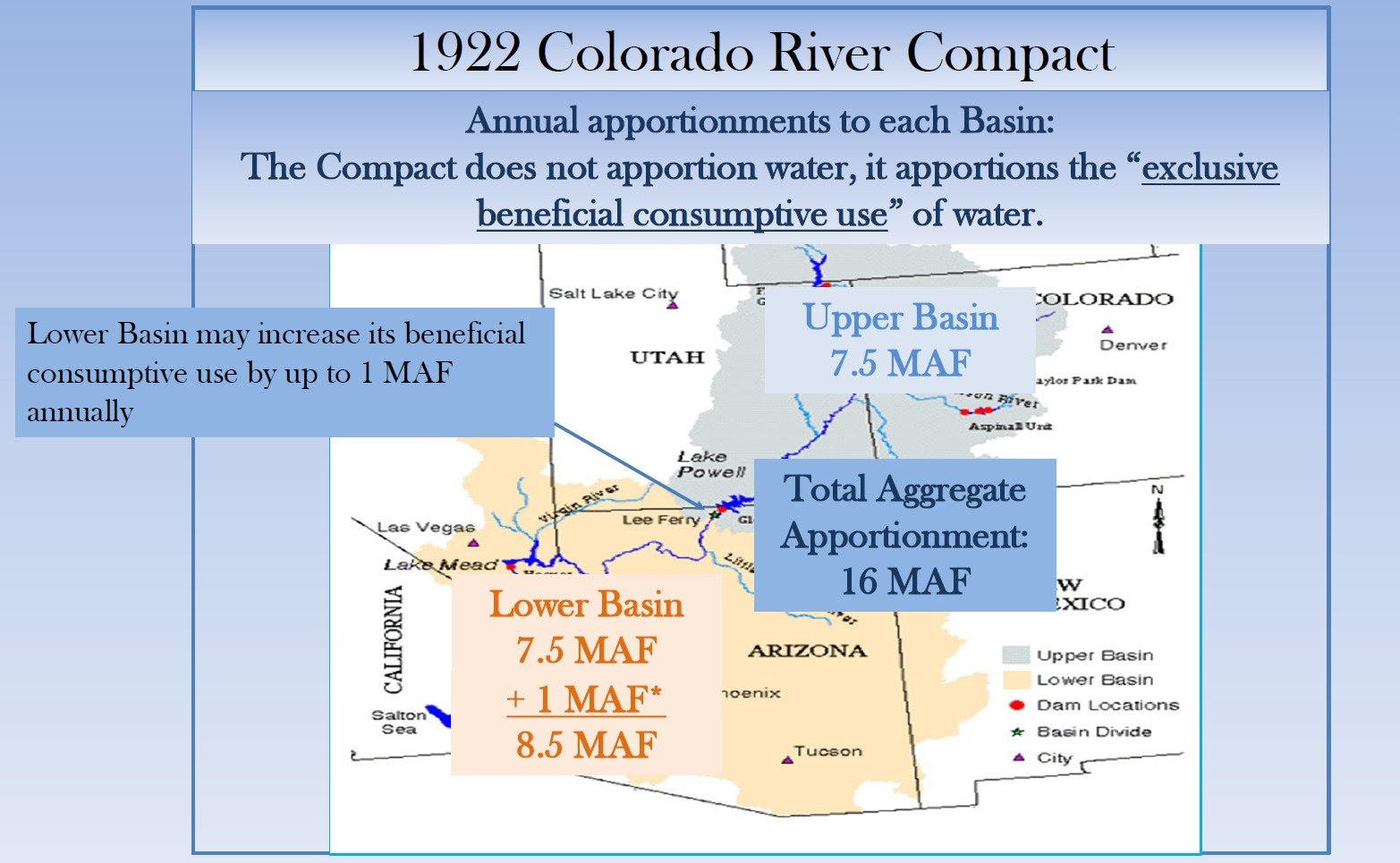
Dividing the river at Lee Ferry: After significant discussion on how to split the river flow—by state or Upper and Lower Basins—the CRCC agreed to an Upper and Lower Basin 50/50 split at Lee Ferry, one mile below the mouth of the Paria River below modern-day Glen Canyon Dam. (Fun fact: Lee Ferry is not to be confused with Lees Ferry, the historic river crossing that today is the launch point for commercial and private boaters through the Grand Canyon and the location of the USGS gage currently used the measure deliveries to the Lower Basin).
With the above data, the Commission attempted to split the flow at Lee Ferry 50/50 but there was no gage at that location. In my reading of the 800+ pages of minutes, the following is how compact eventually arrived at the agreement that the Upper Basins states will not cause the flow at Lee Ferry to be depleted below 75 MAF over a 10-year rolling average:
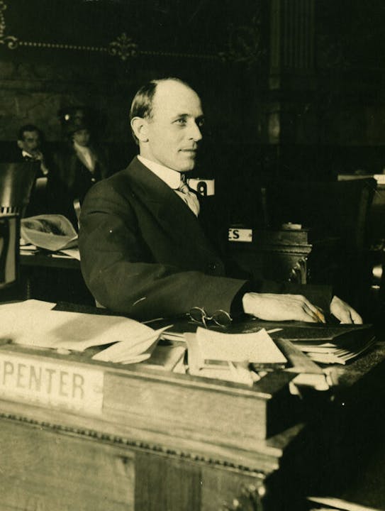
The Upper Basin’s opening position: Colorado representative Delph Carpenter’s initial proposal assumed 17.4 MAF at Yuma and he estimated 14.9 MAF at Lee Ferry including 2.5 MAF below Lee Ferry to get to 17.4 MAF at Yuma. He based the Lower Basin getting 2.5 MAF or 14% of river below Lee Ferry, so the Lower Basin was only entitled to 36% of the river at Lee Ferry which was then 6.5 MAF.
The Lower Basin’s opening position: The Lower Basin calculation was 16+- MAF at Lee Ferry, of which they believed they should get about half, which they determined to be 8.2 MAF. Their position was that the inflow below Lee Ferry was theirs to use without sharing.
Finding a middle ground: Later in the negotiations, after the 10-year rolling average was generally agreed, there was an exchange between Mr. Scrugham from Nevada, who said, “If the Upper Basin will only guarantee sixty-five million acre-feet per 10 years (6.5 AF per year), we might as well abandon the discussion.” Immediately after that statement, Mr. Davis from New Mexico countered with “I think we could say the same thing of the lower states. If the lower states are set on eighty-two million (8.2 MAF per year), we might as well abandon the discussion.”

Those two amounts set the boundaries for negotiations; not surprisingly, the parties agreed upon almost the exact mid-point between their respective positions. The average of 6.5 and 8.2 MAF is 7.35 MAF. Mr. Hoover proposed in the negotiations that the Upper Basin provide 7.5 MAF per year and 75 MAF over the 10-year rolling average period. Hoover eventually had the group vote on the 75 MAF plan after days of discussion and it passed.
Given that there was no data at Lee Ferry. the negotiators were estimating the flow at that location and how much came in below Lee Ferry. The 75 MAF could have been higher or could have been lower and ended up in almost the exact middle.
Of note, 17.4 MAF commonly used today as the estimate in 1922 was at Yuma not Lee Ferry. The annual average flow at Lee Ferry was estimated by the Commission to be in the 15+- MAF range.
What’s next? It’s timely to reflect on these negotiations as we read about Reclamation’s request that the Colorado River basin states develop a plan to cut 2-4 MAF this summer and fall. The Colorado River Compact and the subsequent Upper Colorado River Basin Compact were negotiated to address the current shortage situation. We had nearly 100 years with these compacts being in the background, they are now in the forefront.
Harris Water Engineering has been in business for nearly 40 years and is one of 28 local partners that support the Water Information Program which provides balanced water educational programs and content to southwest Colorado. Thank you!


